-->


-----------
------------------------------
letztes Beben(Kanarische Inseln ( IGN)

Bebenmap( El Hierro)

GPS deformation measure stations on El Hierro

MODVOLC/ Hawaii thermal alerts:

^
near real time thermal alert
for El Hierro, la Palma, Teneriffe and la Gomera ( updated once per week)
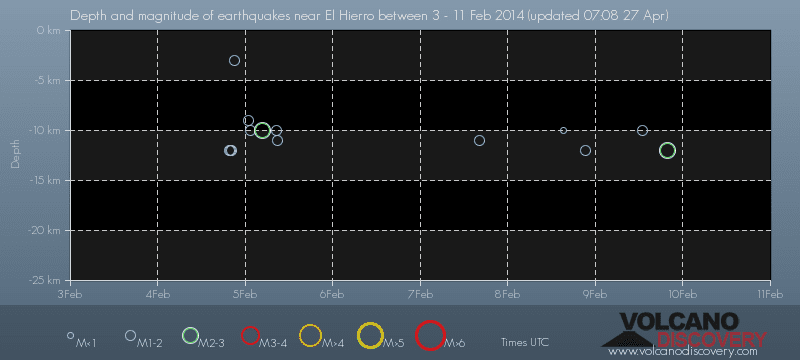
volcano discovery. com : Earthquake within 30 km radius around El Hierro:
-------
---------------
February 10- 16- 2014
January 15- 19- 2014
January 20- 27- 2014

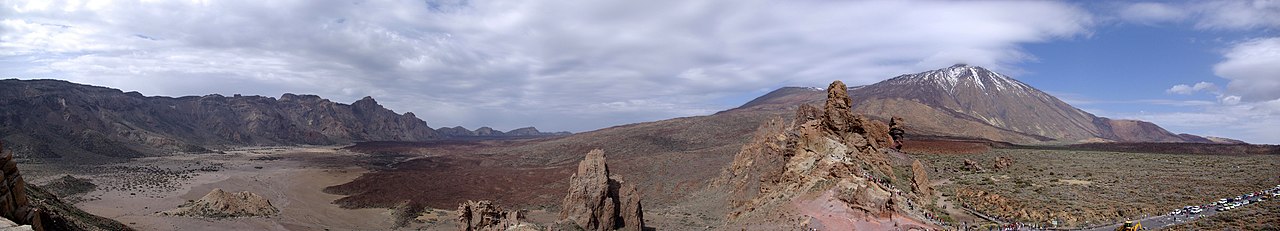
Mnt Teide ( Teneriffe)
VOLCANOES:
"Eruptions that shook the world"
a very interesting and freely avaible source how volcanoes work where you find all what you want to know about volcanoes
Sources of the volcanic activity at El Hierro ( since 2011):
Some may like to read a review on the volcanic activity below El Hierro in 2011:
Here is a data based report by earthquake .com- an excellent site regularly reporting (what you never get in the news) about Earthquakes and related volcanism
worldnews.com: Special environmental reports about the Canaries
Miscanellous:
Geschichte Teneriffas (deutsch)

Fataga ( Gran Canaria)
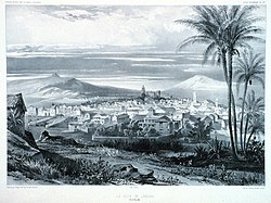
San Cristóbal de La Laguna in 1880 (Tenerife)

Caldera de Taburiente National Park (La Palma).

Garajonay (La Gomera)

(BBC/ 20111204)Canary Island volcano: A new island in the making?
:
:
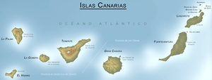
CANARY ISLANDS- ISLAS CANARIAS- KANARISCHE INSELN | ||||||||||||||||||||||||||||||||||||||||||||||||||||||||||||||||||||||||||||||||||||||||||||||||||||||||||||||||||||||||||||||||||||||||
BLOG/ Startseite
| ||||||||||||||||||||||||||||||||||||||||||||||||||||||||||||||||||||||||||||||||||||||||||||||||||||||||||||||||||||||||||||||||||||||||
| internal links > | START | HOME | SOLAR BLOG | VOLCANO WATCH | VOLCANO MAPS | external links > | IGN | AVCAN | AVCAN/ fb. | EMSC | GVP | NOAA |
Activity report here will ony follow, if new events take place. For other environmental reports, please visit the solar and terrestrial blog on my homepage
-------------
-------------
FEBRUARY 17- 2015:
Magmatic quake activity below El Hierro resumed again after February 11 and is almost equally as it was during the latter half of 2014. The depth returned again to an average of 11 km below sea level. Tremors signals increasesd slightly in all island at the same time, what cane be seen as a true indicator, that these quakes are indeed related to a continuing magma intrusion ( with an unknown intensity) from the hot spot and mantle plume below El Hierro.
On February 17, first time- tremor signals were strongest on La Gomera. Allthough all that magma rises up first through the hot spot near to the South of El Hierro but with its mantle plume directly below , tremor signals have the lowest intenisty there - due to the hot temperature , magma has still around El Hierro ) Currently however ( see graphics below) tremor signals are second strongest on El Hierro:
 El Hierro/ 20150217
 La Gomera / 20150217
 Teneriffe / 20150217
Also the quake activity on the fault line between Teneriffe and Gran Canaria continues with a bit higher rate than before and occure still in a depth between 25 and 30 km:
Evento
Fecha
Hora(GMT)*
Latitud
Longitud
Prof.
(km)
Int. Máx.
Mag.
Tipo Mag. (**)
Localización
Info
1317646
17/02/2015
09:47:13
27.6254
-17.9631
12
2.0
mbLg
S EL PINAR.IHI
1317605
17/02/2015
03:28:25
27.6262
-17.9670
11
2.5
mbLg
S EL PINAR.IHI
1317601
17/02/2015
02:11:00
28.3297
-16.4807
28
1.5
mbLg
ATLÁNTICO-CANARIAS
1317484
16/02/2015
00:10:12
28.2154
-16.7250
1.5
mbLg
E GUÍA DE ISORA.ITF
1317402
14/02/2015
07:31:57
28.3331
-16.4889
28
1.5
mbLg
NW REALEJO ALTO.ITF
1317199
13/02/2015
09:50:33
27.7088
-18.0321
11
1.7
mbLg
W EL PINAR.IHI
1316993
12/02/2015
12:09:17
27.7509
-18.2733
2.3
mbLg
W FRONTERA.IHI
-------------------
------------------------
FEBRUARY 11- 2015:
FEBRUARY 17- 2015:
Magmatic quake activity below El Hierro resumed again after February 11 and is almost equally as it was during the latter half of 2014. The depth returned again to an average of 11 km below sea level. Tremors signals increasesd slightly in all island at the same time, what cane be seen as a true indicator, that these quakes are indeed related to a continuing magma intrusion ( with an unknown intensity) from the hot spot and mantle plume below El Hierro.
On February 17, first time- tremor signals were strongest on La Gomera. Allthough all that magma rises up first through the hot spot near to the South of El Hierro but with its mantle plume directly below , tremor signals have the lowest intenisty there - due to the hot temperature , magma has still around El Hierro ) Currently however ( see graphics below) tremor signals are second strongest on El Hierro:
El Hierro/ 20150217La Gomera / 20150217Teneriffe / 20150217Also the quake activity on the fault line between Teneriffe and Gran Canaria continues with a bit higher rate than before and occure still in a depth between 25 and 30 km:
Evento
|
Fecha
|
Hora(GMT)*
|
Latitud
|
Longitud
|
Prof.
(km)
|
Int. Máx.
|
Mag.
|
Tipo Mag. (**)
|
Localización
|
Info
|
1317646
|
17/02/2015
|
09:47:13
|
27.6254
|
-17.9631
|
12
|
2.0
|
mbLg
|
S EL PINAR.IHI
| ||
1317605
|
17/02/2015
|
03:28:25
|
27.6262
|
-17.9670
|
11
|
2.5
|
mbLg
|
S EL PINAR.IHI
| ||
1317601
|
17/02/2015
|
02:11:00
|
28.3297
|
-16.4807
|
28
|
1.5
|
mbLg
|
ATLÁNTICO-CANARIAS
| ||
1317484
|
16/02/2015
|
00:10:12
|
28.2154
|
-16.7250
|
1.5
|
mbLg
|
E GUÍA DE ISORA.ITF
| |||
1317402
|
14/02/2015
|
07:31:57
|
28.3331
|
-16.4889
|
28
|
1.5
|
mbLg
|
NW REALEJO ALTO.ITF
| ||
1317199
|
13/02/2015
|
09:50:33
|
27.7088
|
-18.0321
|
11
|
1.7
|
mbLg
|
W EL PINAR.IHI
| ||
1316993
|
12/02/2015
|
12:09:17
|
27.7509
|
-18.2733
|
2.3
|
mbLg
|
W FRONTERA.IHI
|
-------------------
------------------------
FEBRUARY 11- 2015:
Magmatic activity below El Hierro decreased over the past weeks. there is still a regular quake activity on the tectonic fault between Teneriffe and Gran Canaria in a depth between 09 and 40 km.:
Evento Fecha Hora(GMT)* Latitud Longitud Prof.
(km) Int. Máx. Mag. Tipo Mag. (**) Localización Info 1316786 11/02/2015 12:33:40 28.0642 -16.1889 29 1.6 mbLg ATLÁNTICO-CANARIAS [+] 1316682 11/02/2015 02:13:53 28.0103 -15.0400 9 1.7 mbLg ATLÁNTICO-CANARIAS [+] 1316063 07/02/2015 03:15:47 28.1321 -16.1944 25 1.8 mbLg ATLÁNTICO-CANARIAS [+]

| Evento | Fecha | Hora(GMT)* | Latitud | Longitud | Prof. (km) | Int. Máx. | Mag. | Tipo Mag. (**) | Localización | Info |
| 1316786 | 11/02/2015 | 12:33:40 | 28.0642 | -16.1889 | 29 | 1.6 | mbLg | ATLÁNTICO-CANARIAS | [+] | |
| 1316682 | 11/02/2015 | 02:13:53 | 28.0103 | -15.0400 | 9 | 1.7 | mbLg | ATLÁNTICO-CANARIAS | [+] | |
| 1316063 | 07/02/2015 | 03:15:47 | 28.1321 | -16.1944 | 25 | 1.8 | mbLg | ATLÁNTICO-CANARIAS | [+] |
TREMORS are still present but also decreased significantly over the last weeks. But there is any kind of seismic activity below Teneriffe. I don`t know what the reason is for:
MODVOLC Hawaii issued the following thermal image of the Canaries on 20150211, that shows still presence of hot magma below and between the main islands ( Tenerife, La Palma, La Gomera,, El Hierro. This heat signature is less and only little on Gran Canaria,and there is none only on Fuerteventura and Lanzarote.
-----------
------------------------------
GOOGLE BLOG ARCHIVE
|
Seitenzahl: 03
|
| Latest Post |
| BLOG START/ NAVI |
useful links/ nützliche Links:
|
| EMSC |
| Global Volcanism Program |
| Facebook Seite der AVCAN |
| IGN (Spain) Serie El Hierro |
| Volcano-discovery.com |
| Earthquake- report. com |
MEDIEN:
|
KARTEN:
|
SOLAR (SAT)
|
SOLAR (info)
|
REAL TIME FEATURES:
(click on the images to enlarge them)
(click on the images to enlarge them)
Bebenmap( El Hierro)
GPS deformation measure stations on El Hierro
MODVOLC/ Hawaii thermal alerts:
^
near real time thermal alert
for El Hierro, la Palma, Teneriffe and la Gomera ( updated once per week)
volcano discovery. com : Earthquake within 30 km radius around El Hierro:
-------
---------------
previous posts those contain articles about the Canary volcanism in general:
February 10- 16- 2014
January 15- 19- 2014
January 20- 27- 2014
Mnt Teide ( Teneriffe)
related free online sources:
VOLCANOES:
"Eruptions that shook the world"
a very interesting and freely avaible source how volcanoes work where you find all what you want to know about volcanoes
Sources of the volcanic activity at El Hierro ( since 2011):
Some may like to read a review on the volcanic activity below El Hierro in 2011:
Here is a data based report by earthquake .com- an excellent site regularly reporting (what you never get in the news) about Earthquakes and related volcanism
worldnews.com: Special environmental reports about the Canaries
Miscanellous:
Geschichte Teneriffas (deutsch)

Fataga ( Gran Canaria)

San Cristóbal de La Laguna in 1880 (Tenerife)

Caldera de Taburiente National Park (La Palma).

Garajonay (La Gomera)
(BBC/ 20111204)Canary Island volcano: A new island in the making?