-->
:
:
CANARY ISLANDS- ISLAS CANARIAS- KANARISCHE INSELN | |||||||||||||||||||||||||||||||||||||||||||||||||||||||||||||||||||||||||||||||||||||||||||||||||||||||||||||||||||||||||||||||||||||||||||||||||||||||||||||||||||||||||||||||||||||||||||||||||||||||||||||||||||||||||||||||||||||||||||

BLOG/ Startseite
APRIL 01- 15- 2014
| |||||||||||||||||||||||||||||||||||||||||||||||||||||||||||||||||||||||||||||||||||||||||||||||||||||||||||||||||||||||||||||||||||||||||||||||||||||||||||||||||||||||||||||||||||||||||||||||||||||||||||||||||||||||||||||||||||||||||||
 | 
Activity report here will ony follow, if new events take place. For other environmental reports, please visit the solar and terrestrial blog on my homepage
------------- ACTIVITY REPORTSApril 15- 2014:two minor quake on April 15. Both again form a depth of 10- 12 km- likely a clear sign that magma has reached that level as well:
--------------April 12- 14 2014
Activity increased on April 13 with 4 quakes below El Pinar at the southeastern peak of the island, where the first and yet only eruption took place in 2011. Still the minimal depth remained at 11 km below surface, where I suppose, that the mantle plume ends up in the caldera, from where the uprising magma currently seems to flow into any hollow spaces around, but might create also a new magma chamber with the time.
The M 2.4 quake on April 12/ 00:46 UTC took place below El Tanque ( near Puerto de La Cruz) on the Northern flank of Teneriffe (El Teide).
Later two other minor quakes were measured - one with an unknown depth somewhere between th islands .( I have first to figure out where exactly). The latest on April 14/ at time of this update took place again below the Northeastern part of the island,, where the most quakes happened during this last activity phase since December 23 2013.. HARMONIC TREMORS:Weak tremors are still present on all islands and remain to be still relatively strongest on Gran Canaria and the eastern islands: < Gran Can/ 20140414 < Gran Can/ 20140414
The latest thermal image by MODVOLC shows still a significant heat signature on all islands. The intensity appears to be almost equal since several months,and is still also strongest around the Teide volcano summit and the Northern part of the island of Teneriffe :
 < MODVOLC Thermal alerts/ 20140414 < MODVOLC Thermal alerts/ 20140414------------------April 08- 11 2014One quake on April 09 and again from 11 km depth. Since the yet first and only surface eruption occured late in 2011 no earthquake was registered from a depth higher than 10 km. This is, where the obviously large and wide mantle plume likely ends up at the bottom of the caldera left from a earlier large shield volcano . A caldera is understood an former magma chamber, resp the remnant of a magmabubble a hot spot can just builts up during activity phases until that accumulated magma finally broke through the crust and surface . Today`s Canary islands sit on the edge of that former shield volcano, that once must have existed between today`s islands and the african mainland and which likely collapsed with its last major eruption sometimes in earth history into a caldera .
A Caldera is much like a broken pot and no pressure usually can built up inside necessary for an surface eruption: the uprising magma rather finds still enough empty spaces ,fissures left form the last eruption or can flow from the mantle plume into near rifts, caves or trenches .
The theory however wants to tell us about any magma chamber situated in any depth there that currently "fills up". I dont believe there is any magma chamber left . But there is a wide and intact mantle plume and the uprising magma with a while likely will close and seal all fissures down there and begin then to built up just a new magma bubble , which is understood then as a new "magma chamber"
Latest deformation data show that the latest liftup process again came to a stillstand by now and that el Hierro even settled some centimeter down during the past week. The deformation is caused by the decreasing but extreme gravitational force when magma rises up form the Earth mantle in more than 30- 40 km depth what leads to an extreme expansion of the updwelling magma . Such a magma intrusion finally just forms new rock below the island., The deformation is therfore irreversible. ----------------April 07- 2014
Hot spot activity increased again on April 07, with the latest quake in 11 km depth. :
Again ,there is a minor Proton storm going on since April 05. Interplanetary proton flux is quite high, while the geomagnetic impact strength (integral proton flux) remained below 1 pfu, what means also that the first solar protons emitted usually with higher speed , while the later protons were slown down by the sun and impact with a longer duration.ACCUMULATING SEP events: Protons from previous events are still active within the earth core , while steady new SEP events are coming in one after another since several months now . This is, why the geomagnetic electron flux seems meanwhile to be constantly very down by the proton influence and fell even in negative values . In real the gravity of these protons compress the integral electrons and create a high tension comparable to a spring, that will unleash as soon if proton influence diminuishes and if no new SEPs should occure. < integral electron flux/ April 05. 07.- 2014 < integral electron flux/ April 05. 07.- 2014---------April 02- 06- 2014
Volcanic activity was on low level during the past 4 days with 1 quake every two day in average. The magma intrusion however seems to go on on a minor level . As its is the case with the most volcano systems : If once awoken,( in terms of magma intrusion ) volcano activity does not come to end end so soon. Allthough the Canary volcano system is not comparable to the most active volcanoes on the world, - also the activity there from the hot spot below El Hierro meanwhile continues for more than 3 years with 4 periods of increased activity, and low frequencies of earthquakes in between :
HARMONIC TREMORS
also decreased on all islands and are still ( relatively!) highest on Gran Canaria:

at all, the activity is currently very low and there is currently also no reason to worry about anything like a surface eruption . This- as we know- can change again in the near future . I will continue to monitor the evolution there and post new updates as soon as a new phase with increased activity should take place.
---------------April 01- 02- 2014SPECIAL REPORT:
A major Seaquake occured OFF the Coast of Tarapaca /Chile:
The region was the site of an intensive Earthquake swarm that continues since several weeks, and the 8.0 quake just marks a new peak in this activity that seems to be related to ( or to be the rsult of) intensified tectonic movements and changes all along the entire Pacific coast as well as on a global scale

000
| | |||||||||||||||||||||||||||||||||||||||||||||||||||||||||||||||||||||||||||||||||||||||||||||||||||||||||||||||||||||||||||||||||||||||||||||||||||||||||||||||||||||||||||||||||||||||||||||||||||||||||||||||||||||||||||||||||||||||||
REAL TIME FEATURES:
(click on the images to enlarge them)  Bebenmap( El Hierro)  GPS deformation measure stations on El Hierro  MODVOLC/ Hawaii thermal alerts:  ^ near real time thermal alert for El Hierro, la Palma, Teneriffe and la Gomera ( updated once per week) volcano discovery. com : Earthquake within 30 km radius around El Hierro: 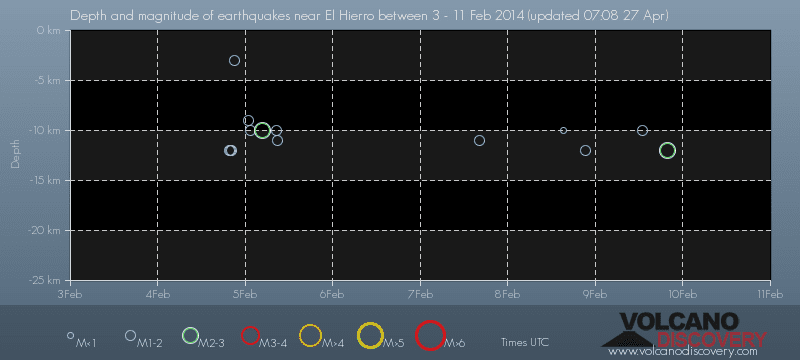 ------- --------------- previous posts those contain articles about the Canary volcanism in general:February 10- 16- 2014 January 15- 19- 2014 January 20- 27- 2014  Mnt Teide ( Teneriffe) related free online sources:VOLCANOES: "Eruptions that shook the world" a very interesting and freely avaible source how volcanoes work where you find all what you want to know about volcanoes Sources of the volcanic activity at El Hierro ( since 2011): Some may like to read a review on the volcanic activity below El Hierro in 2011: Here is a data based report by earthquake .com- an excellent site regularly reporting (what you never get in the news) about Earthquakes and related volcanism worldnews.com: Special environmental reports about the Canaries Miscanellous: Geschichte Teneriffas (deutsch)  Fataga ( Gran Canaria)  San Cristóbal de La Laguna in 1880 (Tenerife)  Caldera de Taburiente National Park (La Palma).  Garajonay (La Gomera)  (BBC/ 20111204)Canary Island volcano: A new island in the making? | |||||||||||||||||||||||||||||||||||||||||||||||||||||||||||||||||||||||||||||||||||||||||||||||||||||||||||||||||||||||||||||||||||||||||||||||||||||||||||||||||||||||||||||||||||||||||||||||||||||||||||||||||||||||||||||||||||||||||||
Keine Kommentare:
Kommentar veröffentlichen