-->

letztes Beben(Kanarische Inseln ( IGN)

Bebenmap( El Hierro)

GPS deformation measure stations on El Hierro

MODVOLC/ Hawaii thermal alerts:

^
near real time thermal alert
for El Hierro, la Palma, Teneriffe and la Gomera ( updated once per week)
volcano discovery. com : Earthquake within 30 km radius around El Hierro:
-------
---------------
February 10- 16- 2014
January 15- 19- 2014
January 20- 27- 2014

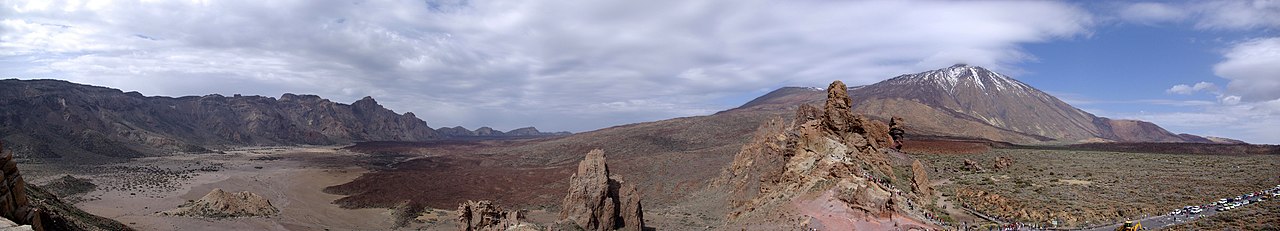
Mnt Teide ( Teneriffe)
VOLCANOES:
"Eruptions that shook the world"
a very interesting and freely avaible source how volcanoes work where you find all what you want to know about volcanoes
Sources of the volcanic activity at El Hierro ( since 2011):
Some may like to read a review on the volcanic activity below El Hierro in 2011:
Here is a data based report by earthquake .com- an excellent site regularly reporting (what you never get in the news) about Earthquakes and related volcanism
worldnews.com: Special environmental reports about the Canaries
Miscanellous:
Geschichte Teneriffas (deutsch)

Fataga ( Gran Canaria)
San Cristóbal de La Laguna in 1880 (Tenerife)

Caldera de Taburiente National Park (La Palma).

Garajonay (La Gomera)

(BBC/ 20111204)Canary Island volcano: A new island in the making?
:
:
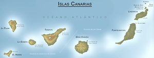
CANARY ISLANDS- ISLAS CANARIAS- KANARISCHE INSELN | ||||||||||||||||||||||||||||||||||||||||||||||||||||||||||||||||||||||||||||||||||||||||||||||||||||||||||||||||||||||||||||||||||||||||||||||||||||||||||||||||||||||||||||||||||||||||||||||||||||||||||||||||||||||||||||||||||||||||||||||||||||||||||||||||||||||||||||||||||||||||||||||||||||||||||||||||||||||||||||||||||||||||||||||||||||||||||||||||||||||||||||||||||||||||||||||||||||||||||||||||||||||||||||||||||||||||||||||||||||||||||||||||||||||||||||||||||||||||||||||||||||||||||||||||||||||||||||||||||||||||||||||||||||||||||||||||||||||||||||||||||||||||||||||||||||||||||||||||||||||||||||||||||||||||||||||||||||||||||||||||||||||||
BLOG/ Startseite
| ||||||||||||||||||||||||||||||||||||||||||||||||||||||||||||||||||||||||||||||||||||||||||||||||||||||||||||||||||||||||||||||||||||||||||||||||||||||||||||||||||||||||||||||||||||||||||||||||||||||||||||||||||||||||||||||||||||||||||||||||||||||||||||||||||||||||||||||||||||||||||||||||||||||||||||||||||||||||||||||||||||||||||||||||||||||||||||||||||||||||||||||||||||||||||||||||||||||||||||||||||||||||||||||||||||||||||||||||||||||||||||||||||||||||||||||||||||||||||||||||||||||||||||||||||||||||||||||||||||||||||||||||||||||||||||||||||||||||||||||||||||||||||||||||||||||||||||||||||||||||||||||||||||||||||||||||||||||||||||||||||||||||
| internal links > | START | HOME | SOLAR BLOG | VOLCANO WATCH | VOLCANO MAPS | external links > | IGN | AVCAN | AVCAN/ fb. | EMSC | GVP | NOAA |
Activity report here will ony follow, if new events take place. For other environmental reports, please visit the solar and terrestrial blog on my homepage.
-------------------
(uncorrected draft!) Magma intrusion from the hot spot below El Hierro that began to resume in December 2013 continued throughout 2014 and in a lower pace also in the first half of 2015. There is a lot of free space in the old caldera in between the islands ( where it mainly runs to since the channel of the first eruption was- as typically sealed with the hard mantle magma when the first eruption ended in 2012 ) The caldera between the islands / the space where once a first giant shield volcano stood , that even connected the islands to the african continental coast.
many giant volcanic remants in the bay south of Agadir show this volcano (while the today canary islands had already formed as secondary shield volcanoes on its edge) once ( and maybe million years ago) suddenly must have exploded , while the rest of the huge crater collapsed to today`s caldera ( likely causing the huge landslides on the other shield volcano peaks found nearby today`s islands) .
This caldera can still withstand the high pressure building up with the uprising mantle magma below by the fact that it is covered with a thick layer of sediments brought along over thousands of years by the sea currents- mainly the Gulf current The Atlantic is generally also a stretching zone and there are also the long cracks parallel to the midatlantic ridge- now juist covered with sand- where magma can run to for a long time until it may reach the surface - or not ( compare:; island volcanoes)
One of thes old channels likely leads to the Volcano Fugo on the Capeverdes, where a first stronger surface eruption occured in spring 2015 bringing up that hot an fluid gasless hot mantle magma that is typical only for hot spots and that covered in just 2 - 3 four days an area of several kilometers around the volcano with a more than 1 meter high lava flow. At the time where this eruption took place, values measured near El Hierro where in deed changing and seemed clearly to correspond with the activity on Fogo, that came to an stillstand about to weeks later.
From begin of the third activity phase on the harmonic tremors ( indicating the movement of hot magma below) had been always strongest around Teneriffe what supported the theory that the magma this time ( after Dec 2013) began to run into the old caldera between ths islands In June 2014, more but mostly single magmatic quakes occured from time to time on Teneriffe itself those have first time reached a depth below 8 kilometers in JUne 2014 . Even the IGN staff clearly stated that these quakes are caused by magma either rising up or - particularly running backwards ( generally that expanding mantle magma can`t run back into the earth mantle again!)
However: until end of 2014, these seldom magmatic quakes in the region of Mount Teide occured again from time to time and always from more shallow depths:_
From Juli/August till the end of the year these single magmatic earthquake below Teide occured in 7 km depth ( below sealevel), then from 6 km depth. And now. after the general activity on most resp. all hot spots worldwide had temporarely decreased) on June 21- 2015, magma underneath Mount Teide first time reached a level of just 4 km below sealevel . The event was associated to an increase of microquake activity on the hot spot and mantle plume ( near El Hierro) itself .
My simple opinion is: DUE TO THE CURRENT SITUATION- FOR SURE! THE RISK IS GETTING HIGHER AND HIGHER RIGHT NOW! The main problem is: The mantle magma contains no explosive gases so it can reach surface only if "pumped" upwards by pressure from the hot spot itself .
The real risk is: as more the magma now comes to the surface ( and the plateau between the islands is just an average of 3.500 meters deep) this magmeacan COME IN CONTACT WITH WATER what than creaztes an explosiuve mixture with hydrogen and SH2 that might lead to a strong initial explosive break through eruption possibly accomponied by pyroclastic clouds.
So at least for the next weeks, anyone on teneriffe should be very aware about what ever happens: there may bee some steam emitting from the ground anywhere as a first sign . vibration in the ground beneath the feet or even any warming up of the ground should be taken vers serious
Due to my resaearch and knowledge, the increasing activity / compare also; Sinabung) is again coincident to a major proton storm that began on June 18- 2015 and still is poing on at time of this update. this SEP ( solar proton event) reached a record of 1.000 pfu ( more in my solar and terrestrial blog on my website):


A shallow but weak quake with W 1.8 was registered today on Teneriffe near to Los Christianos and Playa de las Americas in a depth of 8 km:

however are very low on Tenerife :.
 The MODVOLC thermal hot spot survey . There has been maintainance and also there were obvioulsy made some changes on the MODVOLC website. It shows no discolorisation on any volcano known as active resp on higher alert what indicates the main functions are currently likely out of service. If this is not the reason, why the red colorisation on all volcanoes systems of the islands (which has continued for more than 1, 5 years) has dissapeared over the last weeks , then it would indicate there is more hot magma below the islands:

-------------

tremors had generally rather weakened on Tenerife during the past weeks and temporarely increased on May 12 and further the days after, Tremors reached a temporary peak on May 16 but decreased again since then / the days after:


-----------------------

MODVOLC THERMAL ALERTS
shows still significant heat signatures around the volcano peaks of Teneriffe and La Palma:
(1. REAL TIME IMAGE (automatically updated daily) :

2. THERMAL IMAGE ON 20150419:

---------------------
---------------------------
-------------
-------------------
JUNI 21 2015: FIRST TIME MAGMA WAS RISING UP TO less than 4 km BELOW TENERIFE.
SURFACE ERUPTION IN THE REGION OF MOUNT TEIDE OBVIOUSLY COMES MORE AND MORE CLOSER!(uncorrected draft!) Magma intrusion from the hot spot below El Hierro that began to resume in December 2013 continued throughout 2014 and in a lower pace also in the first half of 2015. There is a lot of free space in the old caldera in between the islands ( where it mainly runs to since the channel of the first eruption was- as typically sealed with the hard mantle magma when the first eruption ended in 2012 ) The caldera between the islands / the space where once a first giant shield volcano stood , that even connected the islands to the african continental coast.
many giant volcanic remants in the bay south of Agadir show this volcano (while the today canary islands had already formed as secondary shield volcanoes on its edge) once ( and maybe million years ago) suddenly must have exploded , while the rest of the huge crater collapsed to today`s caldera ( likely causing the huge landslides on the other shield volcano peaks found nearby today`s islands) .
This caldera can still withstand the high pressure building up with the uprising mantle magma below by the fact that it is covered with a thick layer of sediments brought along over thousands of years by the sea currents- mainly the Gulf current The Atlantic is generally also a stretching zone and there are also the long cracks parallel to the midatlantic ridge- now juist covered with sand- where magma can run to for a long time until it may reach the surface - or not ( compare:; island volcanoes)
One of thes old channels likely leads to the Volcano Fugo on the Capeverdes, where a first stronger surface eruption occured in spring 2015 bringing up that hot an fluid gasless hot mantle magma that is typical only for hot spots and that covered in just 2 - 3 four days an area of several kilometers around the volcano with a more than 1 meter high lava flow. At the time where this eruption took place, values measured near El Hierro where in deed changing and seemed clearly to correspond with the activity on Fogo, that came to an stillstand about to weeks later.
From begin of the third activity phase on the harmonic tremors ( indicating the movement of hot magma below) had been always strongest around Teneriffe what supported the theory that the magma this time ( after Dec 2013) began to run into the old caldera between ths islands In June 2014, more but mostly single magmatic quakes occured from time to time on Teneriffe itself those have first time reached a depth below 8 kilometers in JUne 2014 . Even the IGN staff clearly stated that these quakes are caused by magma either rising up or - particularly running backwards ( generally that expanding mantle magma can`t run back into the earth mantle again!)
However: until end of 2014, these seldom magmatic quakes in the region of Mount Teide occured again from time to time and always from more shallow depths:_
From Juli/August till the end of the year these single magmatic earthquake below Teide occured in 7 km depth ( below sealevel), then from 6 km depth. And now. after the general activity on most resp. all hot spots worldwide had temporarely decreased) on June 21- 2015, magma underneath Mount Teide first time reached a level of just 4 km below sealevel . The event was associated to an increase of microquake activity on the hot spot and mantle plume ( near El Hierro) itself .
IS AN ERUPTION NEAR TEIDE NOW IMMINENT?
My simple opinion is: DUE TO THE CURRENT SITUATION- FOR SURE! THE RISK IS GETTING HIGHER AND HIGHER RIGHT NOW! The main problem is: The mantle magma contains no explosive gases so it can reach surface only if "pumped" upwards by pressure from the hot spot itself .
The real risk is: as more the magma now comes to the surface ( and the plateau between the islands is just an average of 3.500 meters deep) this magmeacan COME IN CONTACT WITH WATER what than creaztes an explosiuve mixture with hydrogen and SH2 that might lead to a strong initial explosive break through eruption possibly accomponied by pyroclastic clouds.
So at least for the next weeks, anyone on teneriffe should be very aware about what ever happens: there may bee some steam emitting from the ground anywhere as a first sign . vibration in the ground beneath the feet or even any warming up of the ground should be taken vers serious
Due to my resaearch and knowledge, the increasing activity / compare also; Sinabung) is again coincident to a major proton storm that began on June 18- 2015 and still is poing on at time of this update. this SEP ( solar proton event) reached a record of 1.000 pfu ( more in my solar and terrestrial blog on my website):
JUNE- 26- 2015:
IGN registered two microquakes more near to Mount Teide on Teneriffe, but can`t say in which depth thes occured:
| Evento | Fecha | Hora(GMT)* | Latitud | Longitud | Prof. (km) | Int. Máx. | Mag. | Tipo Mag. (**) | Localización | Info |
| 1335735 | 27/06/2015 | 16:02:47 | 28.1652 | -16.1650 | 24 | 1.5 | mbLg | ATLÁNTICO-CANARIAS | [+] | |
| 1335653 | 26/06/2015 | 08:46:57 | 29.4587 | -13.7291 | 10 | 1.9 | mbLg | ATLÁNTICO-CANARIAS | [+] | |
| 1335483 | 25/06/2015 | 01:50:37 | 28.1680 | -16.2203 | 30 | 1.6 | mbLg | ATLÁNTICO-CANARIAS | [+] | |
| 1335506 | 24/06/2015 | 13:23:13 | 27.9816 | -16.5530 | 1.5 | mbLg | SE SAN MIGUEL.ITF | [+] | ||
| 1335505 | 23/06/2015 | 13:56:03 | 28.0173 | -16.5512 | 1.6 | mbLg | SE SAN MIGUEL.ITF | [+] | ||
| 1335237 | 22/06/2015 | 20:05:25 | 27.6680 | -18.0513 | 26 | 1.5 | mbLg | SW EL PINAR.IHI | [+] |
-------------------------------------
JUNE- 21- 2015:
| Evento | Fecha | Hora(GMT)* | Latitud | Longitud | Prof. (km) | Int. Máx. | Mag. | Tipo Mag. (**) | Localización | Info |
| 1335048 | 21/06/2015 | 10:12:59 | 27.7384 | -18.1027 | 11 | 1.8 | mbLg | W FRONTERA.IHI | [+] | |
| 1335042 | 21/06/2015 | 07:45:09 | 28.1723 | -16.2454 | 54 | 1.7 | mb | ATLÁNTICO-CANARIAS | [+] | |
| 1334788 | 18/06/2015 | 05:57:06 | 28.2419 | -16.5412 | 4 | 1.7 | mbLg | NW ARICO.ITF | [+] | |
| 1334333 | 14/06/2015 | 22:54:45 | 28.1168 | -16.1446 | 22 | 1.5 | mbLg | ATLÁNTICO-CANARIAS | [+] | |
| 1334296 | 14/06/2015 | 05:35:27 | 28.9365 | -18.2686 | 89 | 1.8 | mb | ATLÁNTICO-CANARIAS | [+] | |
| 1334294 | 14/06/2015 | 00:05:13 | 27.6810 | -18.0838 | 18 | 2.6 | mbLg | W EL PINAR.IHI | [+] | |
| 1334291 | 13/06/2015 | 15:20:59 | 28.0001 | -16.1932 | 1.5 | mbLg | ATLÁNTICO-CANARIAS | [+] | ||
| 1334287 | 13/06/2015 | 15:18:02 | 28.0059 | -16.1768 | 29 | 2.6 | mbLg | ATLÁNTICO-CANARIAS | [+] |
AVCAN published a new map showing the distribution of seimis quakes around the Canaries:
---------
JUNE- 18- 2015:
Another stronger major solor protons storm began on 20150618 after 3 UTC and eased until June 22, when the values again began to rise after a succeeding SEP has occured:

The volcano survey on the Canaries measured on JUne 18- at 05:57:06 about (three hours after begin of this SEP) an magmatic M 1.7 quake just 4.1 kilometers below sea surface beneath Mount Teide on Teneriffe , the most shallow one measured since begin of this third activity phase ( that began in December 2013.)
Here the AVCAN report in Spanish:
SISMICIDAD EN EL ARCHIPIELAGO CANARIO. TENERIFE, LA PALMA Y EL HIERRO.- Ayer tuvimos un sismo localizado por el IGN de magnitud 1.7 en la zona de Arico a 4.1 km, bajo la zona del volcán de Siete fuentes.- Pero la realidad es bien distinta, es que hubo algunos sismos mas no localizados a lo largo del día y algunos de ellos con una señal lo suficientemente buena como para haberlo hecho.
1334788 18/06/2015 05:57:06 28.2419 -16.5412 4.1 1.7 NW ARICO.ITF
Cabe preguntarse, ¿por que no se han localizado? por dificultades técnicas, por falta de personal, por desidia o peor aún, por no publicarlos y llevárselos al catalogo "B"como ya hicieron con los sismos de 2010 y 2011 para investigar tal y como denunció Involcan hace unas semanas. Recuerdo a todos los que lean esto, que el IGN no es un OPI (organismo público de Investigación) y por tanto primero ha de publicar los datos y luego si quiere pueden usarlos para hacer investigación y no al revés como si puede hacer por ejemplo el CSIC.
Les dejo un listado de las señales reconocibles como sismos en forma de lineas verticales en el sismograma de MACI y que no han sido localizados en los últimos tres días, juzguen por ustedes mismos, esta la actividad que puedo observar. (Enrique) read more
here an English trandlation by facebook:
SISMICIDAD EN EL ARCHIPIELAGO CANARIO. TENERIFE, LA PALMA Y EL HIERRO.- Ayer tuvimos un sismo localizado por el IGN de magnitud 1.7 en la zona de Arico a 4.1 km, bajo la zona del volcán de Siete fuentes.- Pero la realidad es bien distinta, es que hubo algunos sismos mas no localizados a lo largo del día y algunos de ellos con una señal lo suficientemente buena como para haberlo hecho.
1334788 18/06/2015 05:57:06 28.2419-16.5412 4.1 1.7 nw arico. Itf
Cabe preguntarse, ¿por que no se han localizado? por dificultades técnicas, por falta de personal, por desidia o peor aún, por no publicarlos y llevárselos al catalogo "B"como ya hicieron con los sismos de 2010 y 2011 para investigar tal y como denunció Involcan hace unas semanas. Recuerdo a todos los que lean esto, que el IGN no es un OPI (organismo público de Investigación) y por tanto primero ha de publicar los datos y luego si quiere pueden usarlos para hacer investigación y no al revés como si puede hacer por ejemplo el CSIC.
I am leaving you with a list of the signs recognisable as earthquakes in the form of vertical lines in the sismograma of Maci and that have not been located in the last three days, judge for yourselves, this the activity that I can see. (Enrique)
Antesdeayer on Maci: 17:06/2015
- 01:01h - señal muy débil.. es muy raro que la localicen, pero lo hicieron, ya que es un eco de la sismicidad en el Hierro, de un sismos a 1.3 a 23.1 km de profundidad al sur en el mar de las Calmas.
1334649 17/06/2015 01:00:38 27.7065-18.0554 23.1 1.3 W The Pine Forest. Ihi iron
- 02:46 H-Signal Weak to moderate in Maci, but comes from further, specifically in the area of the island of LA Palma where you appreciate best in tbt, and I think that it could have been located because he too is appreciated in The station of iron ctig and in the opinion of la gomera egom and more weak in eoso in Gran Canaria.
- 09.27 H-Signal Very weak.. It is very rare that the locate.
- 09:29 H-Signal Weak... Sometimes have located something.
- 13:02-en adelante por espacio de un par de horas, es el telesismo terremoto de 6.9 en el Atlántico sur que se nota mejor en EGOM como empieza.
- 21:30 H-Signal Weak to moderate... Sometimes have located something.
Yesterday in Maci: 18/06/2015:
- 03.04 H-signal very very weak.. It is very rare that the locate.
- 04.21 H-signal very very weak.. It is very rare that the locate.
- 05.20 H-Signal Very weak.. It is very rare that the locate.
- 05:57 H-Signal Moderate-Located M 1.7 to 4.1 km in arico.
1334788 18/06/2015 05:57:06 28.2419-16.5412 4.1 1.7 nw arico. Itf
- 13:35 H-Signal Moderate-Without Locate? Why?
- 19:57 H-Signal Weak... Sometimes have located something.
- 22.43 H-Signal Very weak.. It is very rare that the locate.
- 23:34h - no se aprecia señal, pero si localizaron algo en el Hierro en donde localizaron uno de M1.4 a 16.7 km que se aprecia débilmente en el espectrograma de CTIG, fuertemente atenuado, dicho sea de paso.
1334828 18/06/2015 23:34:36 27.6803-18.0738 16.7 km 1.4 SW The Pine Forest. Ihi iron
Today on Maci: 19/06/2015
00:25 h-a sign of weak to moderate, tend to localize it, it seems the area of the volcano of in the middle because it is also clear weak at the station of Gran Canaria Eoso.
02:46 h-Signal Very weak... It is strange that the locate.
03:52 h-Signal Weak... Sometimes have located something.
05:40 h-Signal Weak... Sometimes have located something.
05:43 h-Signal Weak... Sometimes have located something.
-----------------
JUNE- 09- 2015:
| Evento | Fecha | Hora(GMT)* | Latitud | Longitud | Prof. (km) | Int. Máx. | Mag. | Tipo Mag. (**) | Localización |
| 1333165 | 07/06/2015 | 06:01:29 | 28.1616 | -16.8711 | 8 | 1.8 | 4 | SW GUÍA DE ISORA.ITF |
----------------
MAY 19- 2015:
Major M 4.5 Earthquake in 59 km depth , North of Canary Islands:
AVCAN made no further comment on this quake
| vento | Fecha | Hora(GMT)* | Latitud | Longitud | Prof. (km) | Int. Máx. | Mag. | Tipo Mag. (**) | Localización | Info |
| 1329986 | 19/05/2015 | 09:06:53 | 29.6842 | -16.3691 | 59 | 4.5 | mb | ATLÁNTICO-CANARIAS | [+] | |
| 1329631 | 15/05/2015 | 21:09:41 | 27.6984 | -18.2053 | 18 | 2.0 | mbLg | SW FRONTERA.IHI | [+] | |
| 1328789 | 12/05/2015 | 02:02:16 | 28.2571 | -16.5048 | 6 | 1.8 | mbLg | NW FASNIA.ITF | [+] | |
| 1328753 | 11/05/2015 | 17:35:11 | 28.3339 | -16.4570 | 31 | 2.5 | mbLg | SW ARAFO.ITF | [+] |
TREMORS
however are very low on Tenerife :.MODVOLC REAL TIME THERMAL IMAGE OF CANARY (daily updated?):
-------------
MAY 12- 2015
another magmatic quake in a shallow depth of just 6 km below sea level was registered today near Guimar in the southeast of Teneriffe. AVCAN made no special comment on that:
| Evento | Fecha | Hora(GMT)* | Latitud | Longitud | Prof. (km) | Int. Máx. | Mag. | Tipo Mag. (**) | Localización |
| 1328789 | 12/05/2015 | 02:02:16 | 28.2571 | -16.5048 | 6 | 1.8 | 4 | NW |
tremors had generally rather weakened on Tenerife during the past weeks and temporarely increased on May 12 and further the days after, Tremors reached a temporary peak on May 16 but decreased again since then / the days after:
-----------------------
MAY 01- 07- 2015:
Magmatic activity near the El Hierro hotspot increased slightly during May 1- likely a new magma boost. THe M 2.7 quake on May 01 21:45:08 was felt by residents on El Hierro.| Evento | Fecha | Hora(GMT)* | Latitud | Longitud | Prof. (km) | Int. Máx. | Mag. | Tipo Mag. (**) | Localización | Info |
| 1327751 | 04/05/2015 | 01:52:16 | 29.3677 | -14.8084 | 30 | 2.0 | mbLg | ATLÁNTICO-CANARIAS | [+] | |
| 1327493 | 01/05/2015 | 21:45:08 | 27.7178 | -17.9541 | 13 | Sentido | 2.7 | mbLg | NE EL PINAR.IHI | [+] |
| 1327489 | 01/05/2015 | 11:25:30 | 27.7357 | -18.3216 | 12 | 2.1 | mbLg | W FRONTERA.IHI | [+] | |
| 1327422 | 01/05/2015 | 03:39:22 | 27.7368 | -18.1568 | 38 | 2.5 | mbLg | W FRONTERA.IHI | [+] | |
| 1327421 | 01/05/2015 | 03:14:15 | 27.7369 | -18.1369 | 36 | 2.0 | mbLg | W FRONTERA.IHI | [+] | |
| 1327305 | 29/04/2015 | 20:05:30 | 27.7047 | -18.0210 | 12 | 2.1 | mbLg | W EL PINAR.IHI | [+] | |
| 1327184 | 28/04/2015 | 22:45:55 | 27.8913 | -18.1437 | 1.6 | mbLg | NW FRONTERA.IHI | [+] | ||
| 1327153 | 28/04/2015 | 18:00:27 | 27.6618 | -18.1364 | 17 | 2.2 | mbLg | SW EL PINAR.IHI | [+] | |
| 1326966 | 28/04/2015 | 07:08:22 | 28.3403 | -16.4231 | 29 | 2.0 | mbLg | W ARAFO.ITF | [+] | |
| 1326956 | 28/04/2015 | 06:28:00 | 28.3323 | -16.4041 | 30 | 2.3 | mbLg | SE ARAFO.ITF | [+] | |
| 1326951 | 28/04/2015 | 06:21:59 | 28.3331 | -16.4043 | 30 | 1.9 | mbLg | SE ARAFO.ITF | [+] | |
| 1326947 | 28/04/2015 | 06:14:08 | 28.3389 | -16.4106 | 30 | 1.6 | mbLg | E ARAFO.ITF | [+] | |
| 1326954 | 28/04/2015 | 04:55:44 | 28.3299 | -16.3941 | 30 | 1.6 | mbLg | NE GÜÍMAR.ITF | [+] | |
| 1326912 | 27/04/2015 | 12:04:48 | 28.0570 | -16.1828 | 28 | 1.7 | mbLg | ATLÁNTICO-CANARIAS | [+] | |
| 1326287 | 24/04/2015 | 00:10:09 | 27.9302 | -15.0956 | 32 | 2.7 | mbLg | ATLÁNTICO-CANARIAS | [+] |
APRIL 07- 19- 2015:
Magmatic activity below El Hierro obviously increased during the past week with up to 3 microquakes per day: Interestingly they all came- (differently to previous ones those were all in a depth of about 07- 15 km) from depths between 13- 31 km , with the most deeper than 20 km. So- as it seems ( and differently to the previous ones those rather were caused by expansion forces in the uprising material from previous boosts) these new quakes indicate a NEW BOOST of mantle magma within the mantle plume which has its origen in the hot spot and earth mantle:
| Evento | Fecha | Hora(GMT)* | Latitud | Longitud | Prof. (km) | Int. Máx. | Mag. | Tipo Mag. (**) | Localización | Info |
| 1325759 | 18/04/2015 | 03:45:25 | 28.1318 | -16.1917 | 23 | 1.7 | mbLg | ATLÁNTICO-CANARIAS | [+] | |
| 1325758 | 17/04/2015 | 23:50:48 | 28.2255 | -16.2099 | 31 | 1.7 | mbLg | ATLÁNTICO-CANARIAS | [+] | |
| 1325725 | 17/04/2015 | 18:42:02 | 27.7427 | -18.0223 | 14 | 1.7 | mbLg | SW FRONTERA.IHI | [+] | |
| 1325417 | 16/04/2015 | 06:39:42 | 27.7833 | -18.1570 | 29 | 2.2 | mbLg | W FRONTERA.IHI | [+] | |
| 1325410 | 16/04/2015 | 02:39:03 | 27.7634 | -18.1526 | 28 | 2.0 | mbLg | W FRONTERA.IHI | [+] | |
| 1325362 | 15/04/2015 | 10:32:19 | 27.7892 | -18.1552 | 26 | 1.9 | mbLg | W FRONTERA.IHI | [+] | |
| 1325286 | 14/04/2015 | 23:41:19 | 27.8977 | -18.0733 | 1.8 | mbLg | NW FRONTERA.IHI | [+] | ||
| 1325216 | 14/04/2015 | 10:33:06 | 27.7505 | -18.1740 | 31 | 2.0 | mbLg | W FRONTERA.IHI | [+] | |
| 1325141 | 14/04/2015 | 07:06:07 | 27.7103 | -18.1861 | 25 | 1.8 | mbLg | W FRONTERA.IHI | [+] | |
| 1325079 | 13/04/2015 | 21:28:24 | 27.7693 | -18.1871 | 27 | 2.0 | mbLg | W FRONTERA.IHI | [+] | |
| 1325075 | 13/04/2015 | 17:45:30 | 27.7934 | -18.1872 | 26 | 1.7 | mbLg | W FRONTERA.IHI | [+] | |
| 1325074 | 13/04/2015 | 16:25:46 | 27.8004 | -18.1190 | 24 | 2.1 | mbLg | NW FRONTERA.IHI | [+] | |
| 1325055 | 13/04/2015 | 15:12:01 | 27.6723 | -18.0808 | 22 | 1.5 | mbLg | SW EL PINAR.IHI | [+] | |
| 1325052 | 13/04/2015 | 14:22:00 | 27.8034 | -18.1413 | 28 | 2.1 | mbLg | NW FRONTERA.IHI | [+] | |
| 1324958 | 12/04/2015 | 16:20:03 | 27.7301 | -17.9925 | 13 | 1.6 | mbLg | NW EL PINAR.IHI | [+] | |
| 1324666 | 09/04/2015 | 21:31:03 | 27.7070 | -18.0172 | 11 | 1.8 | mbLg | W EL PINAR.IHI | [+] | |
| 1324579 | 09/04/2015 | 05:57:55 | 28.0606 | -15.1307 | 14 | 1.8 | mbLg | ATLÁNTICO-CANARIAS |
TREMORS
Tremor activity however is currently very low and was - at time of this update- relativeley strongest on la Gomera:MODVOLC THERMAL ALERTS
shows still significant heat signatures around the volcano peaks of Teneriffe and La Palma:
(1. REAL TIME IMAGE (automatically updated daily) :
2. THERMAL IMAGE ON 20150419:
---------------------
---------------------------
APRIL 01- 06- 2015:
No significang activities during the first week of April 2015, As there was some major activity at the end of March ( with one new magmatic quake near el Hierro that could be felt all over the island) I recommend to read last month`s
posting in which I just updated all important informations about these latest events.
posting in which I just updated all important informations about these latest events.
-------------
GOOGLE BLOG ARCHIVE
|
Seitenzahl: 03
|
| Latest Post |
| BLOG START/ NAVI |
useful links/ nützliche Links:
|
| EMSC |
| Global Volcanism Program |
| Facebook Seite der AVCAN |
| IGN (Spain) Serie El Hierro |
| Volcano-discovery.com |
| Earthquake- report. com |
MEDIEN:
|
KARTEN:
|
SOLAR (SAT)
|
SOLAR (info)
|
REAL TIME FEATURES:
(click on the images to enlarge them)
(click on the images to enlarge them)
Bebenmap( El Hierro)
GPS deformation measure stations on El Hierro
MODVOLC/ Hawaii thermal alerts:
^
near real time thermal alert
for El Hierro, la Palma, Teneriffe and la Gomera ( updated once per week)
volcano discovery. com : Earthquake within 30 km radius around El Hierro:
-------
---------------
previous posts those contain articles about the Canary volcanism in general:
February 10- 16- 2014
January 15- 19- 2014
January 20- 27- 2014
Mnt Teide ( Teneriffe)
related free online sources:
VOLCANOES:
"Eruptions that shook the world"
a very interesting and freely avaible source how volcanoes work where you find all what you want to know about volcanoes
Sources of the volcanic activity at El Hierro ( since 2011):
Some may like to read a review on the volcanic activity below El Hierro in 2011:
Here is a data based report by earthquake .com- an excellent site regularly reporting (what you never get in the news) about Earthquakes and related volcanism
worldnews.com: Special environmental reports about the Canaries
Miscanellous:
Geschichte Teneriffas (deutsch)

Fataga ( Gran Canaria)

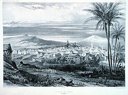
San Cristóbal de La Laguna in 1880 (Tenerife)

Caldera de Taburiente National Park (La Palma).

Garajonay (La Gomera)
(BBC/ 20111204)Canary Island volcano: A new island in the making?
Keine Kommentare:
Kommentar veröffentlichen