-->
:
:
CANARY ISLANDS- ISLAS CANARIAS- KANARISCHE INSELN | ||||||||||||||||||||||||||||||||||||||||||||||||||||||||||||||||||||||||||||||||||||||||||||||||||||||||||||||||||||||||||||||||||||||||||||||||||||||||||||||||||||||||||||||||||||||||||||

BLOG/ Startseite
ACTIVITY/ DECEMBER 01- 31 2014
| ||||||||||||||||||||||||||||||||||||||||||||||||||||||||||||||||||||||||||||||||||||||||||||||||||||||||||||||||||||||||||||||||||||||||||||||||||||||||||||||||||||||||||||||||||||||||||||
 | 
Activity report here will ony follow, if new events take place. For other environmental reports, please visit the solar and terrestrial blog on my homepage
------------- ACTIVITY REPORTS- DECEMBER 01- 31 2014DECEMBER 23- 24:
While the sun produced since Dec 13 several minor SEP events ( from those the current proton storm is the strongest ) ,

also magmatic intrusion resumed or increased again on several hot spots. While the "global magma level" near hot spots seems to be currently in a depth of 5- 10 km, Magmatic activity also increased on the Canary hotspot :
Since the third activity phase began in December 2013, there was yet only one M 5.1 quake which happened early in 2014 in the Atlantic between Teneriffe and La Palma that could be felt as a ground shaking on the aneighbored islands and which even caused minor damage such as by rockfalls ) . But that was a quake form a TECTONIC activity on a larger scale and not directly or only related to the Canary hotspot. But- allthough the new magmatic intrusion continues since then. absolutely NOTHING as it seems yet became obvious on the surface as a typical sign of this volcanic activity! Just during major tourist season of the year on the Canaries...
the first time
now first time at ALL a MAGMATIC quake occured below El Hierro that could be felt on the surface by residents mainly in the area of El PINAR in the Southeast of El Hierro. IGN has not published this eyewitness report and we again don´t know exactly, what it was- maybe something like a stronger surface tremor. What I`d like to know, is: Was it related to a significant warming in the ground?
:
 Everyone can imagine what that can mean---. Magma however is still rising further below the canary islands, and has reached already a level of 5- 7 km , on which any contact with water could cause an explosive eruption on a bigger scale . The plateau however. the Canaries are situated on seems to be perfectly sealed ( at least against the sea water above!) by the mass of sediments the Atlantic currents have brought along there and deposited over ages . How long this seal still will/ can withstand the magmatic pressure from below is the main question now. However a stronger earthquake that would cause a crack in that part of the crust would be one scenario in which water can get into that magma bubble . The consequences might be low if that explosive eruption would then also occure subseas but would be dramatic if Mt Teide or el Pico Veja on La Palma would still be the easiest way that pressure can find its way out (through their volcanic chimneys- the ventils these volcanoes have already provided since ages). With this- only estimable- HIGH amount of magma whioch has accumulated since End 2013 below the Canaries an explosive event when magnma burst its final way free there could be so strong that it triggers landslides (including the widely discussed "WORST CASE" the BBC Tsunami scenario) , but likely might also set free a major , hot pyroclastic cloud in the first phase of a real surface eruption ( containing hot explosively burning gases such as hydrogen formed by the contact of hot magma and seawater) ---------------DECEMBER 15
Additional:
MODVOLC thermal image of the Yellowstone caldera/ 20141216:
 | | ||||||||||||||||||||||||||||||||||||||||||||||||||||||||||||||||||||||||||||||||||||||||||||||||||||||||||||||||||||||||||||||||||||||||||||||||||||||||||||||||||||||||||||||||||||||||||
REAL TIME FEATURES:
(click on the images to enlarge them)  Bebenmap( El Hierro)  GPS deformation measure stations on El Hierro  MODVOLC/ Hawaii thermal alerts:  ^ near real time thermal alert for El Hierro, la Palma, Teneriffe and la Gomera ( updated once per week) volcano discovery. com : Earthquake within 30 km radius around El Hierro: 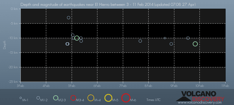 ------- --------------- previous posts those contain articles about the Canary volcanism in general:February 10- 16- 2014 January 15- 19- 2014 January 20- 27- 2014  Mnt Teide ( Teneriffe) related free online sources:VOLCANOES: "Eruptions that shook the world" a very interesting and freely avaible source how volcanoes work where you find all what you want to know about volcanoes Sources of the volcanic activity at El Hierro ( since 2011): Some may like to read a review on the volcanic activity below El Hierro in 2011: Here is a data based report by earthquake .com- an excellent site regularly reporting (what you never get in the news) about Earthquakes and related volcanism worldnews.com: Special environmental reports about the Canaries Miscanellous: Geschichte Teneriffas (deutsch)  Fataga ( Gran Canaria)  San Cristóbal de La Laguna in 1880 (Tenerife)  Caldera de Taburiente National Park (La Palma).  Garajonay (La Gomera)  (BBC/ 20111204)Canary Island volcano: A new island in the making? | ||||||||||||||||||||||||||||||||||||||||||||||||||||||||||||||||||||||||||||||||||||||||||||||||||||||||||||||||||||||||||||||||||||||||||||||||||||||||||||||||||||||||||||||||||||||||||||


Keine Kommentare:
Kommentar veröffentlichen