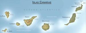
CANARY ISLANDS- ISLAS CANARIAS- KANARISCHE INSELN | ||||||||||||||||||||||||||||||||||||||||||||||||||||||||||||||||||||||||||||||||||||||||||||||||||||||||||||||||||||||||||||||||||||||||||||||||||||||||||||||||||||||||||||||||||||||||||||||||||||||||||||||||||||||||||||||||||||||||||||||||||||||||||||||||||||||||||
BLOG/ Startseite
| ||||||||||||||||||||||||||||||||||||||||||||||||||||||||||||||||||||||||||||||||||||||||||||||||||||||||||||||||||||||||||||||||||||||||||||||||||||||||||||||||||||||||||||||||||||||||||||||||||||||||||||||||||||||||||||||||||||||||||||||||||||||||||||||||||||||||||
| internal links > | START | HOME | SOLAR BLOG | VOLCANO WATCH | VOLCANO MAPS | external links > | IGN | AVCAN | AVCAN/ fb. | EMSC | GVP | NOAA |
Activity report here will ony follow, if new events take place. For other environmental reports, please visit the solar and terrestrial blog on my homepage
----------------------------
----------------------------
MAY 29-2016: CALDERA CLOSE TO ERUPTION?
Magma has reached a level of around 4 km below sealevel within the caldera -mainly between Teneriffe and Gran Canaria and is still on the rise.
( I dould not copy some previous events with several magmatic quakes from a depth of 4 km. But the latest event list shows even that magma rose in one wek 1 km higer and is therefore rapidly further rising. I also don`t want to paint something morre black as it is, but all these data show that we might NOW REALLY be shortly before a larger surface eruption, that- as I personally mean- could become a catastrophic event:
| Evento | Fecha | Hora(GMT)* | Latitud | Longitud | Prof. (km) | Int. Máx. | Mag. | Tipo Mag. (**) | Localización | Info |
| ign2016klvo | 28/05/2016 | 18:44:23 | 27.9507 | -16.3030 | 3 | 1.9 | mbLg | ATLÁNTICO-CANARIAS | [+] | |
| ign2016kkmb | 28/05/2016 | 00:48:12 | 29.7253 | -14.4531 | 4 | 2.2 | mbLg | ATLÁNTICO-CANARIAS | [+] | |
| ign2016kisb | 27/05/2016 | 01:32:57 | 28.0320 | -16.2000 | 1.5 | mbLg | ATLÁNTICO-CANARIAS | [+] | ||
| ign2016kfxp | 25/05/2016 | 12:56:47 | 28.1309 | -16.2606 | 1.9 | mbLg | ATLÁNTICO-CANARIAS | [+] | ||
| ign2016kfxo | 25/05/2016 | 12:55:56 | 28.1081 | -16.1296 | 2.3 | mbLg | ATLÁNTICO-CANARIAS | [+] | ||
| ign2016kdgg | 24/05/2016 | 01:55:05 | 28.0202 | -16.2506 | 27 | 1.9 | mbLg | ATLÁNTICO-CANARIAS | [+] | |
| ign2016jwhe | 20/05/2016 | 06:26:10 | 27.7547 | -18.2207 | 30 | 3.0 | mbLg | W FRONTERA.IHI | [+] | |
| ign2016jvtz | 19/05/2016 | 23:46:28 | 28.2191 | -16.3672 | 30 | 1.5 | mbLg | SE FASNIA.ITF | [+] | |
| ign2016jvgs | 19/05/2016 | 17:04:34 | 28.0577 | -16.4750 | 1.6 | mbLg | SE GRANADILLA DE ABONA.ITF | [+] |
----------------------------------
MAY 10-2016:
At begin of May 2016, a new serial of earthquakes from shallow depth occured between Teneriffe an Gran Canaria mainly near towards the eastern coast of Teneriffe.
The latest one just occured on the day of this update and had a magnitude of M 3.3. IGN has not published the depth of this recent quake , which is therefore still unknown:
The previous one on May 7 had a depth of just 3 km, which sets a new mark as the most shallow likely magmatic quake since begin of this 3 activity phase end of December 2014.

At all three low magnitude qaukes from 6, 9 and 3 km depth indicate something is going on there. Since solar SEPs ( proton events) have decreased significantly after the last 11 year sun spot maximum in 2013, also hotspot activity worldwide has decreased.
Proton events with their subsequent electron accumulations in the Earth`s magnetic field charge the earth with lot of electric energy that is effective for month and even years in different forms of activity , Though SEPs were much less in 2015 and even less in 2016 yet, other types -socalled filament eruptions - still eject mainly proton charged material ( in DC definition "negative" charged) from the Sun`s surface to the earth what each time leads to minor and stronger geomagnetic storms .
But there seems not to be an effect to volcanoes by these filament eruptions . However-.- activity on all important hot spot points globally also decreased since the earth got now first time since 3 years time slowly to cool down again .
Yellowstone, Etna, Sinabung , Kilauea have returned to normal activity and the water level in white island caldera on New Zealand dropped for two meters following the decrease in global hot spot activity- so reports Brad Scott for geonet that monitors the volcanoes in the Southern Pacific and near Australia, "while the volcanoe is still at unrest":
White Island Crater Lake level drops, unrest continues
While magmatic inflation leads logically to an equivalent subduction process elsewhere, expanding magma that once rose up from the mantle , while creating immense forces that inflates / lifts up entire landscapes, islands or mountains cannot flow back again into the earth mantle and therefor deformations by magmatic inflation are unlikely to receed again. However some contraction effects , when magma cools down near the surface can surely create/ leave holes thoswe particularly could collapse .
El Hierro also does not show any sign to sink back to the level it was prior to the third activity phase beginning in end of December 2014 . With the main magmatic intrusion following soon after the island of El Hierro has been lifted up for about 2- 25 cm.Since February 2015 the magmatic intrusion continued with minor strength:

 Its just: that I don`t have the experience, to say what happens next and whether these shallow quakes indicate such a minor collapse by colling donw magma or: that magma would still rise upofurther . So-I would strongly recommend to observe closely the quake activity then next time .
| Evento | Fecha | Hora(GMT)* | Latitud | Longitud | Prof. (km) | Int. Máx. | Mag. | Tipo Mag. (**) | Localización | Info |
| ign2016jdpy | 10/05/2016 | 01:17:23 | 28.0576 | -19.2942 | 3.3 | mbLg | ATLÁNTICO-CANARIAS | [+] | ||
| ign2016iywy | 07/05/2016 | 11:08:38 | 28.4426 | -17.4700 | 3 | 2.3 | mbLg | ATLÁNTICO-CANARIAS | [+] | |
| ign2016ixpl | 06/05/2016 | 18:12:28 | 27.6908 | -17.9923 | 9 | 2.0 | mbLg | SW EL PINAR.IHI | [+] | |
| ign2016ixkh | 06/05/2016 | 15:36:18 | 27.6531 | -17.9996 | 10 | 1.8 | mbLg | SW EL PINAR.IHI | [+] | |
| ign2016iwof | 06/05/2016 | 04:27:15 | 27.8528 | -16.1681 | 10 | 1.6 | mbLg | ATLÁNTICO-CANARIAS | [+] | |
| ign2016ivcv | 05/05/2016 | 09:34:28 | 28.2802 | -16.2669 | 26 | 2.6 | mbLg | ATLÁNTICO-CANARIAS | [+] | |
| ign2016isur | 04/05/2016 | 03:11:09 | 28.2489 | -16.2711 | 26 | 1.6 | mbLg | ATLÁNTICO-CANARIAS | [+] | |
| ign2016isud | 04/05/2016 | 02:54:09 | 28.2258 | -16.2935 | 24 | 1.6 | mbLg | ATLÁNTICO-CANARIAS | [+] | |
| ign2016iooq | 01/05/2016 | 19:34:29 | 28.1588 | -16.1994 | 2.6 | mbLg | ATLÁNTICO-CANARIAS | [+] | ||
| ign2016imdq | 30/04/2016 | 11:45:40 | 28.1609 | -16.1920 | 6 | 2.0 | mbLg | ATLÁNTICO-CANARIAS | [+] | |
| ign2016imad | 30/04/2016 | 09:59:13 | 28.2552 | -16.3254 | 11 | 1.6 | mbLg | E FASNIA.ITF | [+] |
The previous one on May 7 had a depth of just 3 km, which sets a new mark as the most shallow likely magmatic quake since begin of this 3 activity phase end of December 2014.
| Evento | Fecha | Hora(GMT)* | Latitud | Longitud | Prof. (km) | Int. Máx. | Mag. | Tipo Mag. (**) | Localización |
| ign2016iywy | 07/05/2016 | 11:08:38 | 28.4426 | -17.4700 | 3 | 2.3 | 4 | ATLÁNTICO-CANARIAS |

At all three low magnitude qaukes from 6, 9 and 3 km depth indicate something is going on there. Since solar SEPs ( proton events) have decreased significantly after the last 11 year sun spot maximum in 2013, also hotspot activity worldwide has decreased.
Proton events with their subsequent electron accumulations in the Earth`s magnetic field charge the earth with lot of electric energy that is effective for month and even years in different forms of activity , Though SEPs were much less in 2015 and even less in 2016 yet, other types -socalled filament eruptions - still eject mainly proton charged material ( in DC definition "negative" charged) from the Sun`s surface to the earth what each time leads to minor and stronger geomagnetic storms .
But there seems not to be an effect to volcanoes by these filament eruptions . However-.- activity on all important hot spot points globally also decreased since the earth got now first time since 3 years time slowly to cool down again .
Yellowstone, Etna, Sinabung , Kilauea have returned to normal activity and the water level in white island caldera on New Zealand dropped for two meters following the decrease in global hot spot activity- so reports Brad Scott for geonet that monitors the volcanoes in the Southern Pacific and near Australia, "while the volcanoe is still at unrest":
White Island Crater Lake level drops, unrest continues
While magmatic inflation leads logically to an equivalent subduction process elsewhere, expanding magma that once rose up from the mantle , while creating immense forces that inflates / lifts up entire landscapes, islands or mountains cannot flow back again into the earth mantle and therefor deformations by magmatic inflation are unlikely to receed again. However some contraction effects , when magma cools down near the surface can surely create/ leave holes thoswe particularly could collapse .
El Hierro also does not show any sign to sink back to the level it was prior to the third activity phase beginning in end of December 2014 . With the main magmatic intrusion following soon after the island of El Hierro has been lifted up for about 2- 25 cm.Since February 2015 the magmatic intrusion continued with minor strength:


The (for me surprisingly) increase in quake activity again at begin of May 2016 after month fo tranquility should be taken seriously.
-----------------------
GOOGLE BLOG ARCHIVE
|
Seitenzahl: 03
|
| Latest Post |
| BLOG START/ NAVI |
useful links/ nützliche Links:
|
| EMSC |
| Global Volcanism Program |
| Facebook Seite der AVCAN |
| IGN (Spain) Serie El Hierro |
| Volcano-discovery.com |
| Earthquake- report. com |
MEDIEN:
|
KARTEN:
|
SOLAR (SAT)
|
SOLAR (info)
|
REAL TIME FEATURES:(click on the images to enlarge them
MODVOLC/ TENERIFE:
MODVOLC/ EL HIERRO:
letztes Beben(Kanarische Inseln ( IGN)

Bebenmap( El Hierro)

GPS deformation measure stations on El Hierro

MODVOLC/ Hawaii thermal alerts:
^
near real time thermal alertfor El Hierro, la Palma, Teneriffe and la Gomera ( updated once per week)
volcano discovery. com : Earthquake within 30 km radius around El Hierro:
-------
---------------
February 10- 16- 2014
January 15- 19- 2014
January 20- 27- 2014
January 28- February 02- 2014

previous posts those contain articles about the Canary volcanism in general:
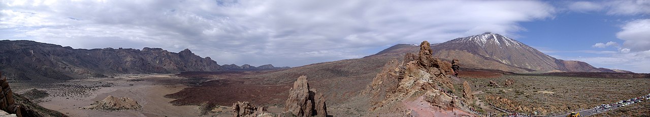
Mnt Teide ( Teneriffe)
related free online sources:
VOLCANOES:
"Eruptions that shook the world"
a very interesting and freely avaible source how volcanoes work where you find all what you want to know about volcanoes
Sources of the volcanic activity at El Hierro ( since 2011):
Some may like to read a review on the volcanic activity below El Hierro in 2011:
Here is a data based report by earthquake .com- an excellent site regularly reporting (what you never get in the news) about Earthquakes and related volcanism
worldnews.com: Special environmental reports about the Canaries
Miscanellous:
Geschichte Teneriffas (deutsch)

Fataga ( Gran Canaria)

San Cristóbal de La Laguna in 1880 (Tenerife)

Caldera de Taburiente National Park (La Palma).

Garajonay (La Gomera)

(BBC/ 20111204)Canary Island volcano: A new island in the making?
Keine Kommentare:
Kommentar veröffentlichen