-->
:
:
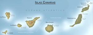
CANARY ISLANDS- ISLAS CANARIAS- KANARISCHE INSELN | |||||||||||||||||||||||||||||||||||||||||||||||||||||||||||||||||||||||||||||||||||||||||||||||||||||||||||||||||||||||||||||||||||||||||||||||||||||||||||||||||||||||||||||||||||||||||||||||||||||||||||||||||
BLOG/ Startseite
week: FEBRUARY 17- 28 2014
| |||||||||||||||||||||||||||||||||||||||||||||||||||||||||||||||||||||||||||||||||||||||||||||||||||||||||||||||||||||||||||||||||||||||||||||||||||||||||||||||||||||||||||||||||||||||||||||||||||||||||||||||||
 |
Activity report here will ony follow, if new events take place. For other environmental reports, please visit the solar and terrestrial blog on my homepage
------------- ACTIVITY REPORTS:Friday- February 28- 2014
no quakes at time of this update ( 07:12 UTC)
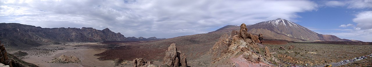
TREMORS: Tremor signals increased on all islands since February 26 . Here today`s plot of Teneriffe  < TENERIFFE/ 20140228 < TENERIFFE/ 20140228 < El Hierro/ 20140228  -- Thursday- February 27- 2014The situation could indeed become serious now: Two new and likely magmatic quakes occured on February 27- 2014- , but not below El Hierro but again on resp near the aneighbored islands: IGN claimed, the depth of both quakes could not be evaluated yet. That is rather suspicious to be part of the desinformation strategy , as it would be the first time , they can`t give any informations about the depth of an earthquakes there. I suppose at least the one near Teide was rather shallow, ( what might be an serious indicator, that a surface eruption on Mt Teide might be imminent!!) Might be, that the Spanish geologists just can`t believe it : I will follow the informations and keep you updated!
The first is of course very suspicious for an surface eruption: its just some Northeast of the Teide massive:  the second was near the eastern islands of Fuerteventura and Lanzerote:  Tuesday- February 25 2014:quakes of the Canaries become more frequent again. Here we have again one minor quake with M 2.0 from 20 km depth

Other related news: The active solar region 11990 has produced an X 1.2 flare today that was associated to a minor proton storm ( SEP)
as the following image by NASA D- RAP shows, these protons impact along the magnetic field lines directly through the Southern pole into the Earth core, where their high accaleration is transformed into heat (This is what leads regularly then the increase of hot spots activities especially on the longitudes where the proton impact was strongest)

. Much of these protons went down over the Atlantic alonmg the 30° E - 60° W longitudes and might amplify volcanic magmatic/ seismic activity there ab bit over the next days.. Active region those produce ARs mostly produce more than one SEP .Thus- hot spot activities are likely i ti increase over the next time
Get a daily update in that on my solar terrestrial blog on my homepage.
seismicity began to increase over the day. Here the plot of Teneriffe:

-------------
Monday- February 24 2014:
one quake today - this time below the island of El Hierro:

seismicity remained low on all islands
here the seismographic plot of Teneriffe --------------- Sunday- February 23 2014: update 2:
Another quake - again located between the islands of Teneriffe and Gran Canaria, (see also report of Feb 21)
update 1: A minor quake today below the Esstern part of El Hierro:
TREMORS: Tremor signals are down on all islands and remain relatively highest on Gran Canaria and the eastern islands MODVOLC: MODVOLC hot spot survey shows now changes; heat signatures remained unchanged since January 12 on all islands: ---- -------------------- Friday- February 21 2014: update (2): Another quake today: the second one below the Western part of El Hierro:
update (1): after 4 days of silence, another minor quake in a depth of 24 km.:
 Tuesday- February 18 2014: Where the strong seimic tremor signals on February 16 caused by high waves hitting the islands? Today`s values however look much better:  < La Gomera/ 20140218 < La Gomera/ 20140218
harmonic tremors is still relatively strongest on Gran Canaria, while Teneriffe draws again those weird and confused data plots it did during December and most of January. ( are the distortions caused by any electrical influence?)
 < Gran Canaria/ 20140218 < Gran Canaria/ 20140218
< Teneriffe/ 20140218
------------------------------------------------ Monday- February 17 2014: 2. update: two more quakes- one again on the Western coast of El Hierro. The other near to Puerto de la Cruz , Northern Teneriffe
 first update at 8 UTC: Another minor quake about 1 km off the coast of El Golfo/ La Fontera from a depth of 10 km: (EMSC) M 2.9 - CANARY ISLANDS, SPAIN REGION - 2014-02-17 06:12:32 UTC
map:  Some of the experts say the strong tremors are caused by the storms high waves those hit the islands in this winter, others say waves can`t cause such strong tremors. The climate change on the island however is another and new experience on the canaries and is currently caused by temperature anomalies around the poles, those again are caused by solar SEPs (protons storms). ( find more about that in mysolar and terrestrial blog.) As warmer temperatures become in the Arctic region, as lower is the temperature difference between the Arctic and the Equator regions and as weaker also will be the Gulf current., that usually transport the heat from the Equator to the North,. If the sea currents become slower by such an anomaly, this temperature exchange more and more has to happen through the atmosphere, what creates fierce winds and weather fronts, while the jet stream shifts towards the North. This relationship however meanwhile is something, also the official experts seem to have understood and do confirm: (BBC/ 20140216/ Wavier jet stream 'may drive weather shift' TREMORS:
Tremors increased further on all islands during February 16, decreased again a bit on February 17 and seems currently to be relatively strongest on La Gomera and the Eastern islands.
 < La Gomera/ 20140216 < La Gomera/ 20140216 < La Gomera/ 20140217 < La Gomera/ 20140217
Since Feb 16/ 12 UTC, the machine on Teneriffe shows again the strange " overloaded" pattern it had already in January 2014:
 < Teneriffe/ 20140216 < Teneriffe/ 20140216 Teneriffe/ 20140217 Teneriffe/ 20140217
MODVOLC HOT SPOT SURVEY/ 20140217:

^no visible changes since January 12- 2014
activity reports/ end
--------------- -------- Über diesen Blog/ about this blog:
Ich habe beschlossen den Blog, bzw. zumindest die aktuellen Berichte in englischer Sprache fortzuführen. Mit Englisch lässt sich das alles einfacher kürzer und genauer ausdrücken. Deutsch ist besser zu verwenden für Dichtkunst oder um Geschichten zu erzählen,. Außerdem kann der Blog dann von mehr Menschen gelesen werden. Natürlich können Kommentare weiter in deutsch oder anderen Sprachen verfasst werden
This blog does not intend to give scientific advice or analysis. Its just wants to document the ongoing volcanic activity and the real events how they envolve, what might serve also as a basic for own conclusions.
Recently I decided to continue this blog - at least the activity updates and report- generally in English language. My English might not be perfect, but at least better than an automatic translator.Its easier to express anything in English than in German and it makes the blog easier understandable for international users. Special stories might be written in German. Comments can be posted in all languages, I recommend to use English, so comments are understandable for the most international visitors ---- some remarks about this blog: Generally also want to refer in this blog also to other interesting aspects of the Canaries, many people might not know yet. But- currently I want to document here the new and unexpected volcanic activity that began in 2011 , that has for itself many aspects, worth to review and tell about ---------
------------------
| ||||||||||||||||||||||||||||||||||||||||||||||||||||||||||||||||||||||||||||||||||||||||||||||||||||||||||||||||||||||||||||||||||||||||||||||||||||||||||||||||||||||||||||||||||||||||||||||||||||||||||||||||
REAL TIME FEATURES:
 Bebenmap( El Hierro)  ^ MODVOLC/ Hawaii thermal alerts near real time thermal alert for El Hierro, la Palma, Teneriffe and la Gomera ( updated once per week) volcano discovery. com : Earthquake within 30 km radius around El Hierro:  ------- --------------- previous weeks posts: January 15- 19- 2014 January 20- 27- 2014  Mnt Teide ( Teneriffe) related free online sources:VOLCANOES: "Eruptions that shook the world" a very interesting and freely avaible source how volcanoes work where you find all what you want to know about volcanoes Sources of the volcanic activity at El Hierro ( since 2011): Some may like to read a review on the volcanic activity below El Hierro in 2011: Here is a data based report by earthquake .com- an excellent site regularly reporting (what you never get in the news) about Earthquakes and related volcanism worldnews.com: Special environmental reports about the Canaries Miscanellous: Geschichte Teneriffas (deutsch)  Fataga ( Gran Canaria)  San Cristóbal de La Laguna in 1880 (Tenerife)  Caldera de Taburiente National Park (La Palma).  Garajonay (La Gomera)  (BBC/ 20111204)Canary Island volcano: A new island in the making? | |||||||||||||||||||||||||||||||||||||||||||||||||||||||||||||||||||||||||||||||||||||||||||||||||||||||||||||||||||||||||||||||||||||||||||||||||||||||||||||||||||||||||||||||||||||||||||||||||||||||||||||||||

Keine Kommentare:
Kommentar veröffentlichen